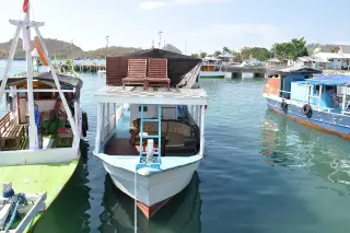
Manggarai Barat’s 9,450-Square-Kilometre Spatial Plan Explained
Manggarai Barat’s 2012–2032 spatial plan, set out in Regional Regulation Number 9 of 2012, covers approximately 9,450 square kilometres of land and sea and provides a 20-year framework for allocating protected and development zones, but…
By Pandi Muktar
Editor: Mursyid Sonsang
· Event date: · 4 min read
Labuan Bajo — — Manggarai Barat’s 2012–2032 spatial plan was adopted as Regional Regulation Number 9 of 2012 and is designed to guide the use of the regency’s land and sea over a 20-year period, according to the official regulation and subsequent planning documents issued by the local government.
The plan is framed as a long-term spatial policy for the entire territory of Manggarai Barat, including both terrestrial and marine areas. It sets out how space is to be allocated between protected zones and development areas, and is used as a reference for investment decisions, permitting and sectoral planning.
According to the text of the regulation as reproduced in a public document, the spatial plan covers “the entire land and sea area of approximately 9,450 km², together with the airspace above and subsurface below, based on administrative and functional aspects.” Recent regional development plans issued by the regency government repeat the same figure, stating that Manggarai Barat has a total area of 9,450 km², with 2,947.50 km² of land and the rest classified as sea.
What Regional Regulation 9 of 2012 establishes
The regulation is formally titled the Spatial Plan of Manggarai Barat Regency 2012–2032 and is cited as Regional Regulation Number 9 of 2012 in legal-information portals and regional planning documents.
The preamble explains that the regency required a spatial plan to direct development and integrate planning across sectors and communities. Subsequent regional development documents describe the spatial plan as a basis for technical and sectoral planning, for investment and for controlling land and sea use in the regency.
The regulation lists national laws on spatial planning and on coastal areas and small islands among its legal foundations, alongside legislation on environmental management, conservation and transport, indicating that the plan is intended to sit within Indonesia’s wider land, coastal and marine planning system.
The plan’s stated time frame is 2012–2032, with the regulation specifying that the spatial plan has a 20-year horizon and can be reviewed at least once every five years or sooner if major environmental or territorial changes occur.
Spatial coverage and marine scope
Planning documents issued after the regulation confirm that Manggarai Barat’s administrative area is understood to be 9,450 km², of which 2,947.50 km² is land and roughly 64 percent is sea. These documents use the spatial plan as a basis for describing coastal and marine potential, including transport and fisheries.
The regulation divides space into protected and development areas, and later reports summarising the spatial plan identify protected zones such as forest conservation areas and coastal buffers, including a coastal setback of 100 metres from the highest tidal point in several coastal districts.
Official maps linked to the spatial plan show the regency’s boundaries with the Flores Sea to the north, the Savu Sea to the south, Manggarai Regency to the east and the Sape Strait to the west, and depict a range of terrestrial and coastal conservation and development zones.
Why marine provisions require status checks
While the spatial plan clearly covers both land and sea, planning documents published in the 2020s state that the 2012–2032 spatial plan is in the process of being revised in line with Manggarai Barat’s emerging role as a national tourism destination. In addition, a spatial-information system operated by the regency references a newer regional regulation on the spatial plan for the period 2021–2041.
Those references indicate that the original 2012–2032 plan has been subject to review and that a later spatial-planning instrument exists, but they do not by themselves set out how individual marine zones or allocations from Regional Regulation 9 of 2012 have been amended, superseded or carried forward.
For residents, fishers, tourism operators and investors, the key point is that the 2012 spatial plan provides a documented framework for how Manggarai Barat intended to organise its land and sea, and that it has been used as a basis for regional planning and permitting. However, determining the current legal force of particular marine allocations now requires consulting the full text and maps of both the 2012–2032 regulation and any subsequent spatial-planning regulation, together with relevant provincial and national marine-zoning instruments.
Key figures
- Total spatial coverage: approximately 9,450 km² of land and sea, within Manggarai Barat’s administrative boundaries.
- Land area: about 2,947.50 km², including parts of Flores and islands such as Komodo, Rinca and Longos.
- Sea area: the remainder of the 9,450 km² territory, accounting for around 64 percent of the regency’s area in recent planning documents.
- Regulation: Regional Regulation Number 9 of 2012 on the Spatial Plan of Manggarai Barat Regency.
- Planning period stated in the regulation: 2012–2032, with a 20-year horizon and periodic review.
Sources
- Manggarai Barat Regency Government legal-information portal (PDF: Peraturan Daerah RTRW 2012–2032)
- Scribd copy of Manggarai Barat RTRW regulation
- National legal-information network (JDihn) entry for Perda No. 9 of 2012
- Universitas Atma Jaya Yogyakarta thesis chapter on Manggarai Barat
- Indonesian-language encyclopaedia entry on Manggarai Barat
- Manggarai Barat spatial-information system (MAB-STAR)
Next story
Wuring Father and Son Found Adrift After Losing Contact on Selayar Voyage
Two Wuring fishermen reported missing en route from Sikka to Karumpa Island in South Sulawesi’s Selayar Islands were found alive adrift between Sukun…
Related