Rinca’s Loh Buaya Visitor Loops and the Mapped Doro Ora Trail
Three ranger-led trekking loops from Loh Buaya currently define the standard visitor experience on Rinca Island, while a separate 2021 hiking map shows a longer trail to the 735‑metre Doro Ora summit whose public-access status is not set…
Editor: Mursyid Sonsang
· 5 min read
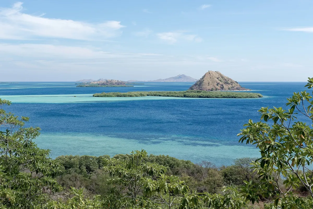
Labuan Bajo — — Rinca Island’s visitor trekking today is organised around three ranger-led routes from the Loh Buaya station, while a separate 2021 hiking map shows a longer trail toward the 735‑metre Doro Ora summit whose public-access status is not documented in current visitor guidance.
Operator guidance updated in August 2026 describes three loop routes at Loh Buaya — commonly referred to as short, medium and long options — all of them led by park rangers rather than independent hikers, according to Rinca-focused travel information and regional tour operators.
Those sources say every visitor trek on Rinca begins at Loh Buaya, the island’s single ranger station and jetty, and that unguided walking on the island is not permitted under park rules.
Typical walking times are given as roughly 20–45 minutes for the shortest loop and up to around two to two and a half hours for the longest circuit, with the longer trail climbing to ridge viewpoints over the bay and surrounding islands.
For travellers comparing itineraries, the most consistent picture in the August 2026 material is that Loh Buaya offers a managed visitor format built around a choice of three ranger-led route lengths, each starting and ending at the same station.
The available operator and guide accounts, however, do not reproduce a formal Balai Taman Nasional Komodo (BTNK) document naming each Loh Buaya route, assigning official difficulty grades or setting out a booking procedure in BTNK’s own words.
Loh Buaya as the visitor gateway
Rinca visitor information published in 2026 characterises Loh Buaya as the island’s only entry point for standard tourism visits.
Facilities at the station are described as basic — including restrooms, a small ranger office and shaded waiting areas near the jetty — with no restaurant or reliable drinking‑water refill station, meaning visitors are advised to bring their own food and water for the duration of the trek.
Multiple travel guides emphasise that every trekking group must be accompanied by a licensed BTNK ranger, and that independent trekking without a ranger guide is not permitted on any of the Loh Buaya trails.
They also note that visits are structured into daytime sessions rather than open, walk‑up access, and that an advance booking and e‑ticket through the SiORA system has been required for park entry since April 2026.
What the Doro Ora map shows
A separate 2021 hiking map produced by Indogis.ID in conjunction with Gunung Bagging marks both the Loh Buaya ranger station and the Doro Ora summit, labelling the peak at 735 metres above sea level.
The map uses symbols to indicate an “official route” toward Doro Ora and sets out a broader network of terrain features, streams, settlements and elevation contours across Rinca Island and nearby areas.
At the same time, its own cautionary text warns that routes shown may not be open to the public and advises hikers to consult local authorities and landowners before seeking permission to use any trail.
In practice, this means the Doro Ora trail is documented as a 2021 mapped hiking corridor rather than as a confirmed, current public‑access route for ordinary visitors in 2026.
The longer Doro Ora option therefore differs from the Loh Buaya visitor loops in character: it represents a more demanding island hike involving substantial elevation gain, but the available documentation does not provide a verified distance, expected walking time, difficulty rating, guide requirement or a standard visitor itinerary approved by BTNK.
Government trekking‑route design work
The Forestry and Environment Ministry’s Pusat Keteknikan Kehutanan dan Lingkungan lists a design entry dated 25 January 2021 titled “Jalur Trekking di Pulau Rinca Taman Nasional Komodo,” describing an engineering design for trekking routes and supporting facilities on Rinca.
According to that listing, the design work was intended to guide the development and arrangement of trekking corridors and lightweight infrastructure such as elevated platforms, shelters, signage and river‑crossing facilities, using non‑permanent, natural materials and avoiding disturbance to Komodo dragons and other wildlife.
This government design note demonstrates that formal planning for trekking routes and support structures on Rinca has been undertaken as part of Komodo National Park’s development as a priority ecotourism destination.
However, it does not specify which individual routes are currently open, nor does it publish detailed visitor rules such as trail distances, grades, mandatory guide arrangements or operating status for the Doro Ora summit trail.
What visitors should verify before going
Given the gap between mapped routes and confirmed visitor itineraries, travellers planning a Rinca trek should treat the Loh Buaya ranger‑station loops and the Doro Ora map as distinct layers of information.
Before departure, visitors are advised to ask operators or BTNK directly which routes are presently authorised from Loh Buaya, whether a ranger or approved guide is mandatory on each, and whether any longer hikes toward Doro Ora are available as part of the official programme.
They should also seek up‑to‑date information on route conditions, operating hours and any temporary restrictions linked to weather, safety considerations or conservation needs, rather than assuming that every path shown on a 2021 map is automatically open in 2026.
Sources
Next story
Why young Komodo dragons spend their first months in trees
Young Komodo dragons use trees as refuge from adult dragons and other predators. The age at which they move to the ground varies by source, but both a…
Related