
Fence remains at Laing Lewe Beach amid public-access dispute
A wire fence remained at Laing Lewe Beach on 3 November after residents protested restricted shoreline access.
· 2 min read
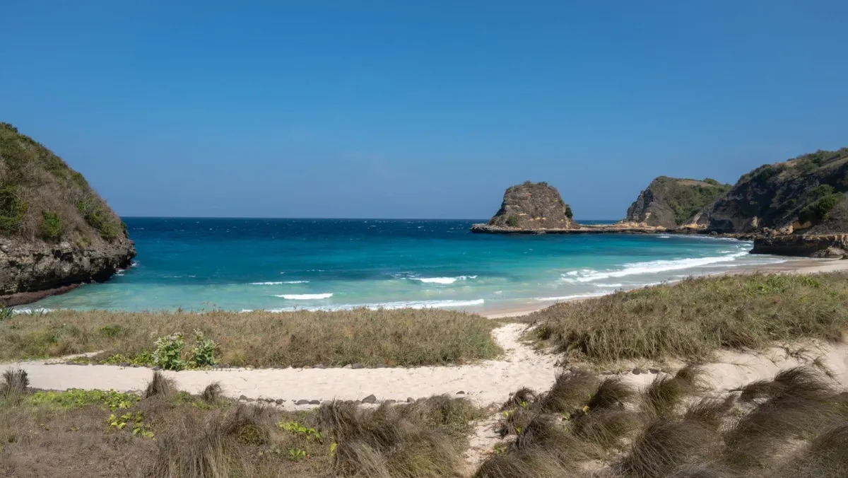
Laing Lewe Beach — A wire fence remained around a coastal parcel at Laing Lewe Beach in Golo Mori Village, West Manggarai, on 3 November 2026, as residents challenged the restriction of access to the shoreline.
Why it matters: The fence restricts access to the shoreline used by residents and traders while authorities have said it conflicts with local coastal-planning rules.
Floresa reported that the fence had been installed in July and that residents had protested it. The report said the fence extended about 800 metres parallel to the shoreline, with a section of about 50 metres running toward the sea and nearly reaching the highest-tide point.
The dispute involves land covered by a certificate of ownership, identified in the report as Certificate of Ownership No. 00016. A sign at the site named Mira Guizot as the owner and warned people not to enter without permission, according to Floresa.
West Manggarai’s spatial-planning authorities said the fencing violated Regent Regulation No. 32 of 2025 on the Detailed Spatial Plan for the Golo Mori Planning Area. Oktavianus Bin Guntur Sukut, head of spatial planning at the regency’s public works and spatial-planning agency, said a fence could not extend to the beach.
Floresa also reported that the coastal setback in the area is governed by national and local rules, including a minimum distance of 100 metres inland from the highest-tide point. The rules also provide for pedestrian routes and public access along the coast.
The National Land Agency office in West Manggarai had not explained the basis for issuing the certificate, the parcel map, its coordinates or the history of transfers by the date of the report. Residents had not removed the fence while awaiting clarification, Floresa said.
The beach, also known as Pasir Panjang, is about 17 kilometres south of Labuan Bajo and faces islands in Komodo National Park, including Rinca, according to the report.
Sources
Read next
More on this story

Labuan Bajo
Komodo Airport rearranges facilities as future land needs await review
Komodo Airport is rearranging facilities on its existing certified land as officials await a master-plan review that will determine whether future exp…
Most read in Komodo National Park

Today’s top story
Related