Rinca’s 5-Hectare Tourism Project on a 20,000-Hectare Island
A tourism project on Rinca Island is reported to occupy 5 hectares on an island of about 20,000 hectares.
Editor: Mursyid Sonsang
· Event date: · 4 min read
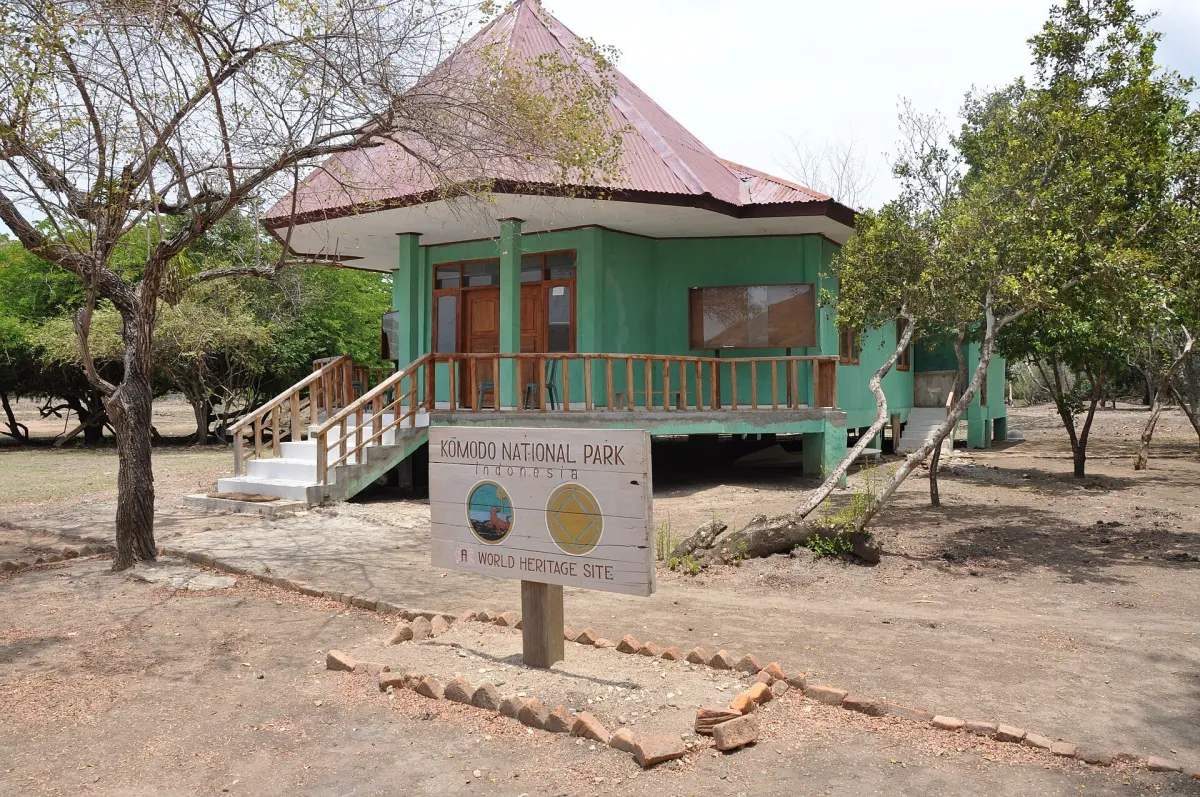
Labuan Bajo — — Tourism infrastructure on Rinca Island is being developed within a reported 5-hectare zone on an island whose land area is commonly cited at around 20,000 hectares. The figures show the designated development footprint is a small portion of the island, but they do not, on their own, describe the project’s full environmental or operational impact.
Officials from East Nusa Tenggara and the national environment ministry have described the Rinca works as part of a strategic tourism initiative within Komodo National Park. According to reporting by The Jakarta Post, provincial spokesman Marius Jelamu said in October 2020 that the project would be built on “5 hectares of the island’s 20,000 hectares of land,” and would include repairs to damaged infrastructure and new visitor facilities.
Tempo English similarly reported that the Ministry of Environment and Forestry stated the development “covers an area of 5 hectares from a total of 20,000 hectares area,” with works led by the Ministry of Public Works and Housing.
VenueMagz, citing Governor Viktor Bungtilu Laiskodat, reported that development on Rinca would support mass tourism
Understanding the two area figures
The reported 5-hectare figure refers to the specific tourism development site on Rinca Island. The approximately 20,000-hectare figure refers to the island’s overall land area, a value also reflected in conservation documents on Komodo National Park zoning and habitat extent. The two numbers therefore describe different scales: a construction and infrastructure footprint on one hand, and the wider island on the other.
On a simple proportional basis, a 5-hectare project on a 20,000-hectare island would represent about 0.025 percent of the island’s land area, or roughly one part in 4,000. This numerical comparison shows the project site is geographically small relative to Rinca as a whole, but it does not indicate how intensively that area will be used, nor how tourism activities and supporting infrastructure may affect nearby zones.
Conservation zoning documents for Komodo National Park describe multiple land and marine zones, including core areas where access is highly restricted, wilderness areas with limited tourism, and designated tourism-use zones. A statement from the park authority in April 2020 noted that the terrestrial tourism-use zone covers 824 hectares, with a separate 1,584-hectare marine tourism-use zone, emphasising that tourism development is confined to those designated areas. The 5-hectare Rinca tourism project sits within this broader zoning framework.
What the project involves
Reports from provincial and national officials, as cited by The Jakarta Post, describe the Rinca project as including renovation of docks, an elevated viewing deck for Komodo dragons, a ranger building, an information center, restaurants and accommodation facilities such as homestays and resorts. Tempo English likewise refers to infrastructure development for tourism as part of Rinca’s role in a strategic national tourism area.
VenueMagz presents the project as a shift toward wider public access or mass tourism, quoting the governor’s comments on making Rinca more open to general visitors rather than an exclusive destination. Environmental groups, including WALHI, have separately raised concerns in reports about “unchecked development” and potential risks to Komodo habitat from tourism-driven projects on Rinca, highlighting tensions between conservation objectives and tourism expansion.
Conservation, access and ongoing debate
The Ministry of Environment and Forestry has argued that tourism activities in the Loh Buaya valley, where many Komodo dragons live, do not endanger the population when strict protection and minimal direct contact between humans and wildlife are maintained. Officials have stressed that the park’s zoning and conservation rules remain in force during the Rinca works, and that tourism is restricted to designated zones.
At the same time, the Rinca project has become a focal point for wider debate over how infrastructure, visitor numbers and conservation controls should operate together across Komodo National Park. Media coverage and civil-society reports frame the question as balancing economic benefits from increased visitors, including the possibility of more mainstream or mass tourism, against the need to protect Komodo dragons and other species and to preserve the park’s ecological integrity.
Within that debate, the 5-hectare tourism site and the approximately 20,000-hectare island area are best understood as reference points for scale, not as a complete measure of the project’s ecological footprint. Roads, utility lines, access routes, vessel traffic and indirect effects on wildlife and habitats may extend beyond the formally demarcated construction zone, and these broader impacts continue to be examined by park authorities, researchers and advocacy groups.
Sources
- The Jakarta Post
- Tempo.co (English edition)
- VenueMagz
- Komodo National Park official zoning page
- WALHI report “Unchecked Development Threatens Komodo National Park”
- KOMODO NATIONAL PARK INDONESIA (UNESCO/IUCN-related documentation)
- KLHK / TN Komodo article on Rinca tourism infrastructure and conservation
- Liputan6
Next story
Komodo National Park planted 250 mangroves at Kampung Kerora in 2020
In late February 2020, Komodo National Park staff and residents of Kampung Kerora on Rinca Island planted 250 native Rhizophora mangrove seedlings to…
Related