Technical Design for Rinca Trekking Routes Emphasizes Low-Impact Facilities
Indonesia’s Forestry and Environmental Engineering Center has published a technical design for trekking routes and supporting facilities on Rinca Island, outlining natural-material, low-impact structures intended to fit the landscape and…
Editor: Mursyid Sonsang
· Event date: · 5 min read
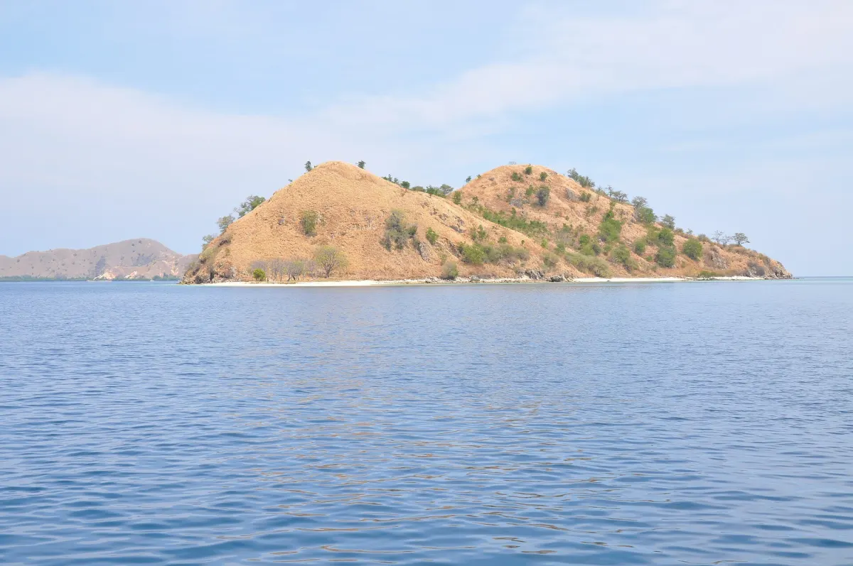
Labuan Bajo — A technical design prepared for trekking routes and supporting facilities on Rinca Island puts the island’s terrain, landscape character and wildlife protection at the center of planning, according to Indonesia’s Forestry and Environmental Engineering Center under the Ministry of Environment and Forestry (KLHK).
The design was drawn up for Komodo National Park by the Forestry and Environmental Engineering Center together with the park’s technical team and landscape-architecture specialists, as part of efforts to organize and develop trekking routes on Rinca. It frames engineering design as a way to integrate new works with infrastructure previously developed by other parties, emphasizing careful coordination with existing facilities and with the conservation landscape.
What the design proposes
According to the technical document, the supporting infrastructure required for trekking on Rinca includes platforms or elevated decks, information boards, signs, shelters and facilities for trekking across rivers. The facilities are to be located at specific points along the routes, with the stated aim of avoiding disturbance to Komodo dragons and other wildlife and remaining in harmony with the island’s landscape.
The design calls for infrastructure that fits the character of the surrounding terrain rather than following a uniform visitor-flow pattern. Placement of decks, shelters or signs is treated as a design issue that must respond to site conditions, such as topography and vegetation, while maintaining visibility and safety for visitors.
The guidance favors facilities that are not permanent, use natural materials and employ a knock-down construction system that can be assembled outside the conservation area and installed on site. It explicitly rejects a “betonisasi” approach based on extensive concrete or cement use, and instead requires structures that visually and physically blend with the landscape.
In practical terms, the design sets out a lighter-footprint system for trekking routes. Elevated structures are intended to help visitors traverse uneven terrain or river crossings, while signs and information boards support orientation and nature interpretation along the trails. The published technical document focuses on principles and types of infrastructure rather than on detailed route maps, dimensions or capacity limits.
Key elements identified in the design include:
- Planning location: Rinca Island within Komodo National Park.
- Proposed facilities: elevated decks, information boards, trail signs, shelters and river-crossing infrastructure.
- Design approach: use of natural materials, non-permanent structures and knock-down construction to minimize concrete and cement.
Tourism policy context
The technical design situates Rinca’s trekking-infrastructure planning within national tourism policy and the wider development of Komodo National Park and Labuan Bajo as priority destinations. Indonesia’s National Tourism Development Master Plan for 2010–2025, established by Government Regulation No. 50 of 2011, identifies Labuan Bajo and Komodo among key tourism development areas and sets targets for infrastructure and access improvements.
Subsequent policy discussions on Komodo National Park promoted a “premium nature tourism” direction, with Komodo Island envisaged as an exclusive, high-fee destination and Rinca positioned to receive more mainstream visitor flows. A working paper on the park’s development notes that ecotourism plans approved in 2020 include designation of the area as a “premium nature tourism site” and construction of new visitor facilities on Rinca Island. National and provincial officials have also stated that non-premium visitors would be directed to smaller islands such as Rinca.
Within this context, KLHK’s Forestry and Environmental Engineering Center prepared the Rinca trekking design to guide future arrangement and development of routes and their supporting infrastructure. The document is intended as a technical reference for planners and park managers, emphasizing conservation principles and landscape-sensitive construction.
Implementation and current trekking routes
The Forestry and Environmental Engineering Center’s publication describes the planned trekking routes and infrastructure but does not itself confirm which structures have been built or provide a comprehensive list of open and closed trails. Separately, Komodo National Park and KLHK have reported ongoing development and utilization of visitor facilities in the Loh Buaya area of Rinca for education and interpretation, indicating that tourism infrastructure on the island is being brought into use in stages.
Beyond Loh Buaya, Komodo National Park has expanded trekking options on Rinca. In March 2025 the park opened a new trekking route at Kampung Kerora, in Pasir Panjang village on Rinca Island, described as the seventh trekking route in the park and offering Komodo viewing and turtle-release activities. Other Rinca-area trekking routes mentioned by the park include Kampung Rinca and resort areas where routes to Batu Balok and Gua Kalong have been mapped for nature tourism.
The available sources show that Rinca’s trekking infrastructure is being developed and put into operation under KLHK and Komodo National Park management, with elevated platforms, shelters and interpretive facilities among the components. They do not, however, provide a detailed, up-to-date trail-status register or a full inventory of which parts of the Forestry and Environmental Engineering Center’s design have been implemented.
Sources
- Pusat Keteknikan Kehutanan dan Lingkungan – Jalur Trekking di Pulau Rinca Taman Nasional Komodo
- Detik.com – Sensasi Melihat Komodo di Jalur Treking Kampung Kerora
- Balai Taman Nasional Komodo – Menelisik Potensi Daya Tarik Wisata Alam Resort Kampung Rinca
- UNESCO World Heritage Centre – State of Conservation 2021: Komodo National Park (Indonesia)
- Kyoto University CSEAS – Working Paper No. 10 on Komodo National Park tourism development
- Reptiles Magazine – Komodo Island Will Be Restricted To Premium Tourists, Won’t Be Closed
- Tempo.co – Pulau Komodo Jadi Wisata Premium, Lapak UMKM Akan Digeser ke Pulau Rinca
Next story
NTT floated digital Komodo monitoring plan for 2020
In December 2019, East Nusa Tenggara officials said they would deploy a Singapore-linked digital system from 2020 to monitor tourism and conservation…
Related