BMKG Warned of 2.5-Metre Waves in Komodo Waters on Sept. 3-4
BMKG warned of waves up to 2.5 metres in Nusa Tenggara Timur, including waters around Komodo, on 3-4 September 2026. The advisory was relevant to Labuan Bajo sailings, but no formal Komodo route closure was reported.
Editor: Mursyid Sonsang
· Event date: · 3 min read
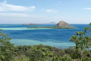
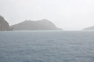
Labuan Bajo — BMKG forecast moderate waves of 1.25 to 2.5 metres in waters around Komodo and other parts of Nusa Tenggara Timur on 3-4 September 2026, according to a report by RRI quoting a BMKG forecaster in Kupang. The advisory was relevant for small boats and tourist departures from Labuan Bajo, but it did not amount to a reported formal closure of any Komodo route.
RRI reported that the forecast came from Arya Dalexta Fadly, a forecaster at BMKG’s Tenau Kupang Meteorological Station. He said the conditions could affect several sea passages in NTT and urged mariners to pay close attention to wind and wave updates before sailing.
The areas named in the report included Selat Sumba, Selat Flores, Selat Lamakera, Selat Tantar and Selat Alor, along with the waters south of Flores and Alor, the western part of Selat Sumba, Laut Sawu, Selat Pukuafu and the waters south of Sumba. RRI also said the forecast covered the waters of Taman Nasional Komodo.
According to the report, the forecast wave range was 1.25-2.5 metres, with northeast-to-southeast winds of about 10-56 kilometres per hour. The marine warning was valid for Thursday, 3 September, through Friday, 4 September 2026.
BMKG’s marine pages for Komodo waters and Labuan Bajo, which are updated separately from the regional bulletin, showed routine maritime forecasts in mid-September 2026 and reinforced the agency’s practice of issuing location-specific sea conditions for the area. The broader September forecast did not, however, state that trips to Komodo, Padar or other park destinations had been cancelled or officially suspended.
For travellers, the practical message was simple: check the latest marine conditions before departure and confirm plans with the vessel operator, especially when sailing on smaller boats. The risk is higher when strong winds and moderate waves combine, which BMKG has identified as a concern for maritime activity in NTT waters.
Waters named in the forecast
- Selat Sumba
- Selat Flores
- Selat Lamakera
- Selat Tantar
- Selat Alor
- South of Flores and Alor
- West of Selat Sumba
- Laut Sawu
- Selat Pukuafu
- South of Sumba
- Sabu Raijua waters
- North of Kupang-Rote
- South of Timor-Rote
- Taman Nasional Komodo waters
The forecast formed part of routine marine-weather guidance for NTT waters and highlighted the need for caution across multiple sea routes used by passenger and fishing vessels. In Labuan Bajo, that guidance matters because even regional warnings can affect whether operators decide to sail on a given day.
Sources
Next story
Komodo tide forecast shows why timing matters for boat trips
Tides4Fishing’s Komodo forecast shows tides ranging from 0.5 to 3.0 metres later in the week, while BMKG’s marine data for the park’s port shows curre…
Related