

Southwest Sumba earthquake revised to magnitude 5.9, no tsunami potential
BMKG revised the earthquake from an initial magnitude of 6.1 to 5.9, said it had no tsunami potential and recorded 62 aftershocks by 8:05 a.m. local time.
· 2 min read
Offshore — An earthquake that BMKG initially measured at magnitude 6.1 struck at 5:55:52 a.m. local time on Sunday, 4 October 2026, before the agency revised the magnitude to 5.9.
Why it matters: The earthquake was felt strongly in parts of Southwest Sumba, had 62 recorded aftershocks by 8:05 a.m., and was assessed as having no tsunami potential.
BMKG said the earthquake occurred at a depth of 30 kilometres and had no tsunami potential. Its epicentre was in the sea off Southwest Sumba, at 9.84 degrees south and 118.90 degrees east.
The Meteorology, Climatology and Geophysics Agency said the quake was felt strongly in parts of the Kodi area. BMKG monitoring recorded 62 aftershocks by 8:05 a.m. local time, ranging from magnitude 1.5 to 4.3.
What BMKG reported
BMKG’s earthquake bulletin identified the event as a tectonic earthquake off the southwest coast of Southwest Sumba. The agency’s tsunami modelling found no potential for a tsunami.
RRI reported that the agency urged residents to remain alert around damaged buildings after the earthquake. The report also repeated BMKG’s revised magnitude, location, tsunami assessment and aftershock count.
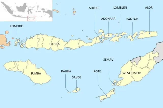
The earthquake occurred outside Komodo National Park but in the wider eastern Indonesian region used by travellers moving between Sumba, Flores and nearby sea routes. The sources report no closure or route suspension.
Sources
Read next
More on this story
Explainers
BMKG warns of 4-metre waves near East Nusa Tenggara
BMKG warned of waves up to 4 metres through 19 November 2026, including waters reaching East Nusa Tenggara, urging marine users to monitor conditions.
Latest in Flores & Beyond
Related